 |
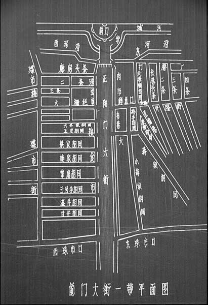
| Our walk through the hutongs was on the east side (the right side of the map above). Most of the pictures were along West Damochang Street 西打磨厂街 (Xīdámóchǎng Jiē). Damochang means "whetstone factory". I assume that at one point there was such a factory in the vicinity.
Many of the narrow alleys between buildings are not shown on the map. They are pathways between the walls surrounding what were once courtyards. The main door of the courtyard would open into the street and, originally, a blank wall was presented to the neighbor. Later, doors and windows were added as the living spaces changed and the area was more secure. The walls surrounding residences, shops, and factories were functional protection. |
http://hua.umf.maine.edu/China/HistoricBeijing/Qianmen/index.html
Last
update: August 2009
© Marilyn Shea, 2009