| The city walls were dismantled in the 1960s, both to provide a place for a new multi-lane highway called the second ring road, and to provide material for an expansive underground bunker system begun to provide air-raid protection during a time of Sino-Soviet tensions. Today, the Second Ring Road links to four more ring roads that serve the ever-expanding city.
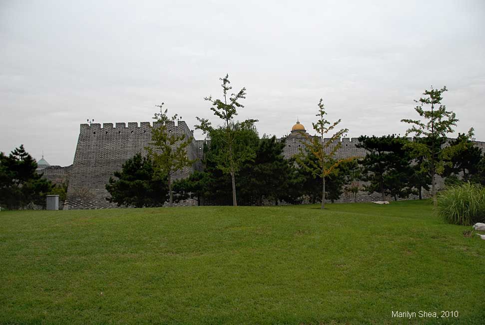
A short segment of the City Wall was preserved. It runs 1.5 kilometers from Dongbianmen to Chongwenmen to the west. The area around the wall serves as a park today, allowing one to walk the length of the wall. Most of the wall is blocked off, having been left in its natural state. A section near the tower has been modernized and made safe for foot traffic.
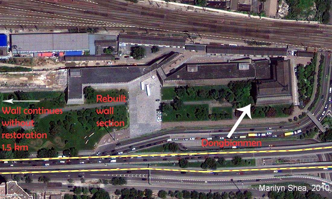
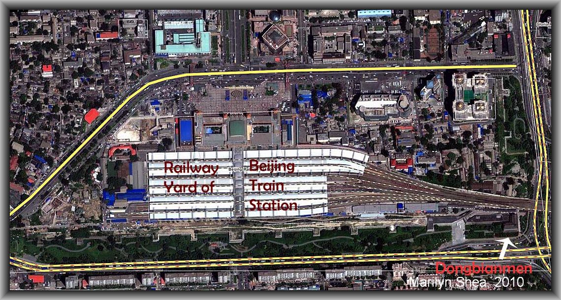
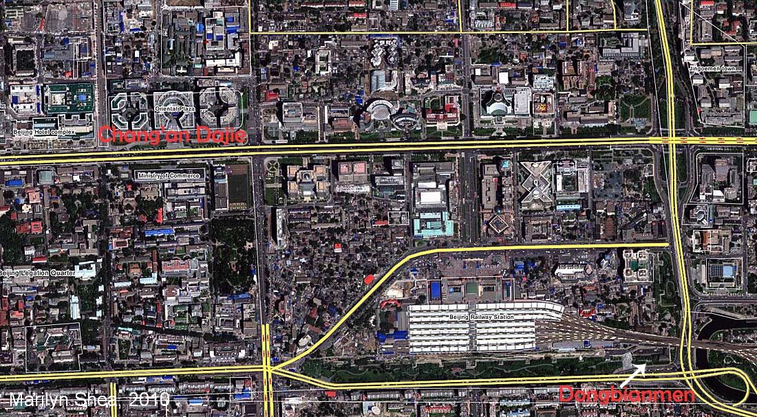
Below, are several maps from Wikimapia showing the placement of the remaining wall and Dongbianmen. In the first map, the grey area at the top is comprised of railway tracks. The archery tower at Donbianmen is at the right side of the picture and is a right-angled building. On the second map, a wider view shows you the location of the Beijing Railway Station and the comparative size. In its day, Dongbianmen was a huge building, but it is dwarfed by the modern office buildings and hotels of today's Beijing. The bottom map includes a section of Chang'an Dajie (Chang'an Avenue), the central avenue of Beijing, which runs past Tian'anmen Square and the Forbidden City. Major government offices, museums, and hotels tower over what used to be one and two-story shops and homes.
The double yellow lines at the bottom of the map mark the location of the Second Ring Road and what once was an open canal that served as part of the defenses for the city of Beijing. Large sections of the canal have been covered over to make roads and space for real estate development. Other sections have remained open and turned into greem spaces for the neighborhoods. There is a section in the southwest running past a large public park, Longtanhu, which is particularly popular with strollers and fishermen.
|


